LIDAR - Light Detection and Ranging, developed in the 1960's. Utilises light from a pulsed laser to measure vertical height of the earth's surface to generate a precise high definition 3D image of the land surface characteristics. The laser scanner is usually carried in an aeroplane and the information is collated with GPS information. The data was made freely available to all in 2015 and is enabling the discovery of numerous previously unknown archaeological sites.
Detailed information about LIDAR available here: www.lidar-uk.com/index.php
New Forest National Park Heritage Mapping (LIDAR) website: www.newforestnpa.gov.uk/conservation/preserving-history-and-culture/heritage-mapping/
Scrollable LIDAR map of The New Forest: lidar.newforestnpa.gov.uk/lidarzoomfull.htm
ARCHI MAPS LIDAR - LIDAR map with aerial photograph overlay, use slider on black bar above the map:
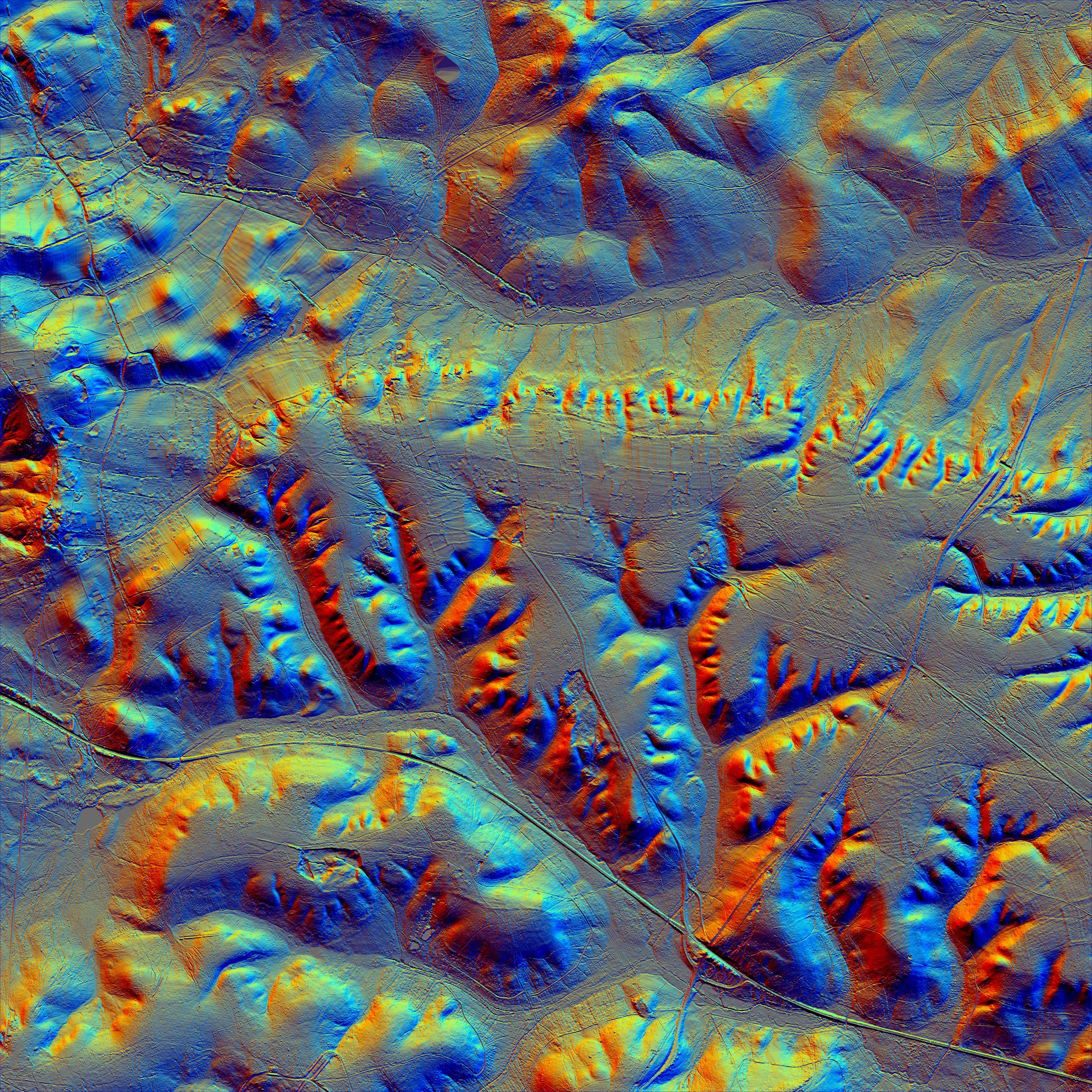
Centred on Burley New Enclosure (Just NE of Burley Village)
Detailed information about LIDAR available here: www.lidar-uk.com/index.php
New Forest National Park Heritage Mapping (LIDAR) website: www.newforestnpa.gov.uk/conservation/preserving-history-and-culture/heritage-mapping/
Scrollable LIDAR map of The New Forest: lidar.newforestnpa.gov.uk/lidarzoomfull.htm
ARCHI MAPS LIDAR - LIDAR map with aerial photograph overlay, use slider on black bar above the map:
Centred on Burley New Enclosure (Just NE of Burley Village)
LIDAR map of Burley (Download the image file below for a significantly enlarged and more detailed view) -
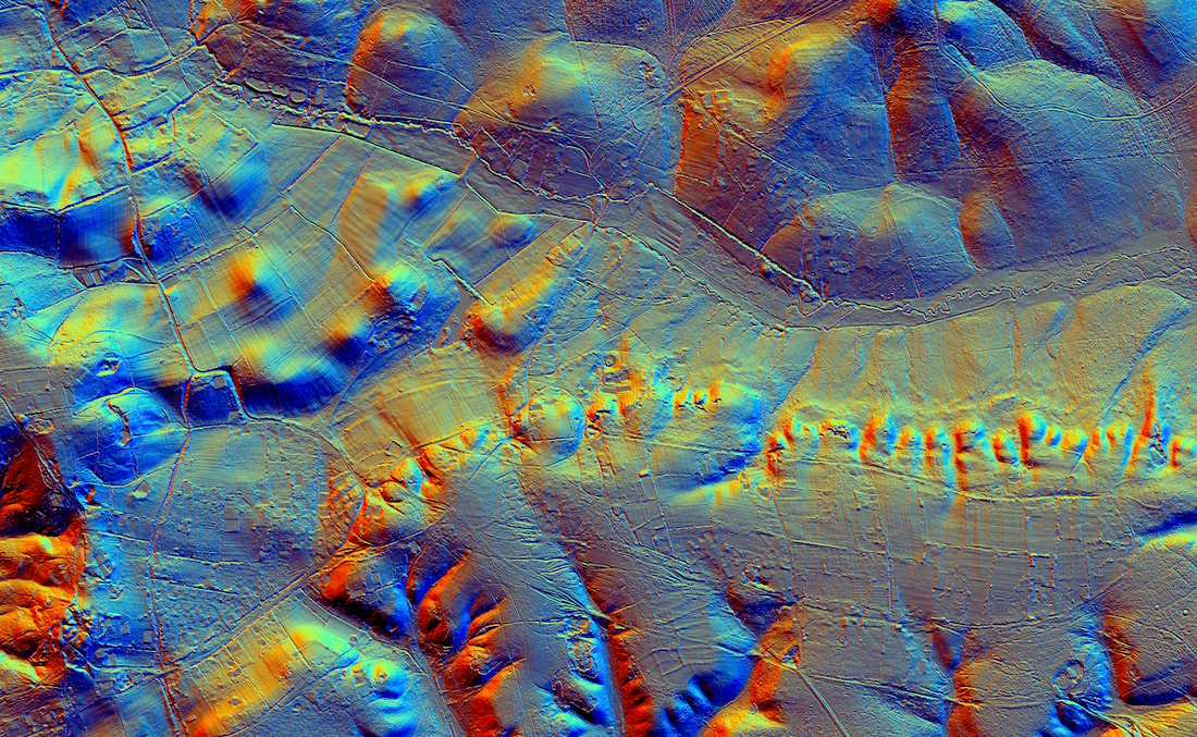
| lidar_burley.jpg |
Image generated using 1 metre National LIDAR Programme DTM (Digital Terrain Model) tiles from DEFRA website - environment.data.gov.uk/DefraDataDownload/?Mode=survey
The DTM tiles have digitally "removed" all vegetation and buildings which are present on the DSM (Digital Surface Model) tiles to give better visualisation of the landscape.
Data then processed using free to download Relief Visualization Toolbox (RVT) software - iaps.zrc-sazu.si/en/rvt#v
Although this may initially look daunting the downloading and processing of images is actually pretty straightforward and the DEFRA files cover the whole of England. You can generate your own location specific LIDAR maps!
Historic England information page on downloading and processing LIDAR tiles -
historicengland.org.uk/content/docs/research/using-ea-lidar-data-pdf/
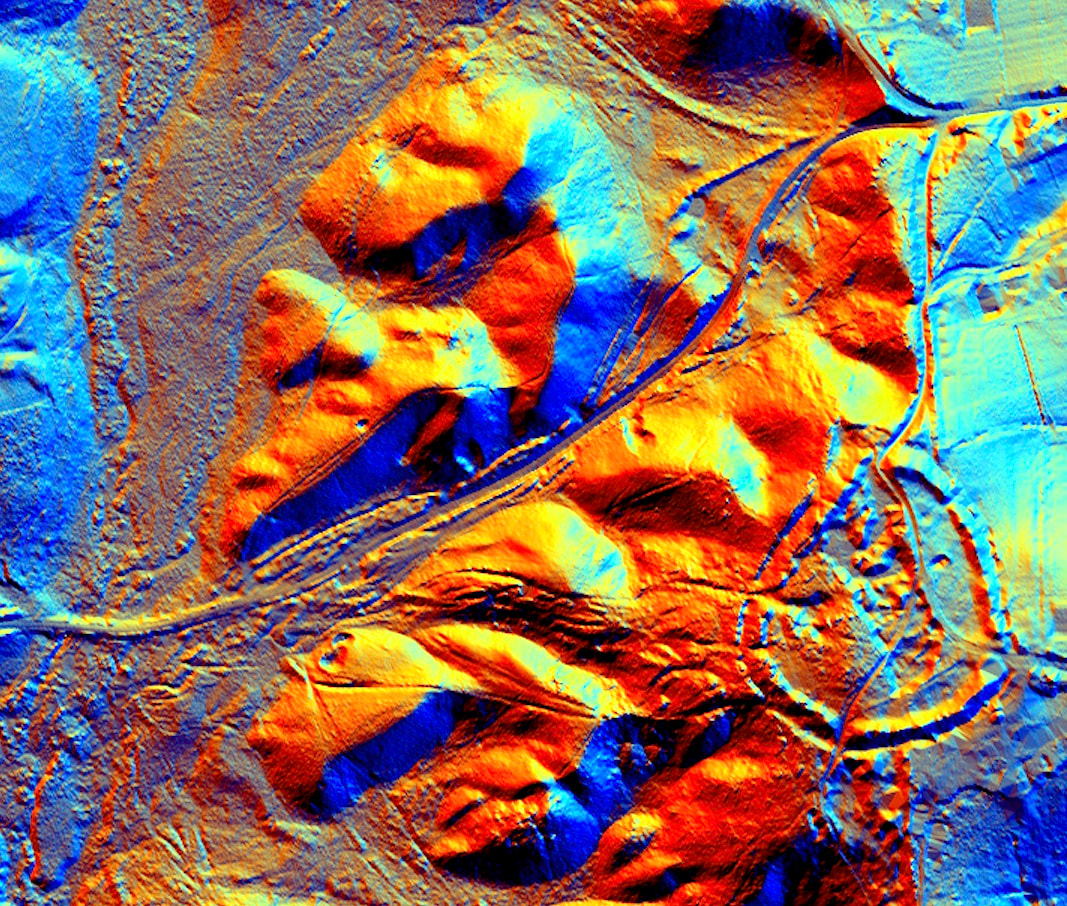
Similarly generated LIDAR map of Castle Hill (bottom right) -
