BURLEY ROCK Jo Smith
In the New Forest most of the sediments are either sands or gravels, so there is little hard rock suitable for building purposes. However, there are deposits of “Ferricretes” which are suitable and have been used over centuries as a construction material for both domestic and farm buildings, and for maintaining the tracks and lanes.
“Ferricrete is the generic name given to the iron oxide-cemented coarse-grained sands, gravels, conglomerates and breccias which have formed within soil and superficial sediments due to the percolation of ferruginous groundwaters. It often occurs on sandy heaths overlying Palaeocene strata in irregular layers up to 50 cm thick.”
Historic England—Historic Stone Survey
Hearthstone, iron pan, and ironstone conglomerate are other names also associated with this deposit.
One example of a ferricrete found in the New Forest is Hasley Hill Hearthstone, found at Hasley Hill in the north of the Forest, to the east of Hyde. Many of the old houses in that area of the Forest have walls containing elements of this material.
However, the most widely used example is our own Burley Rock. Its historical importance is highlighted not only by its locational name, but the use of the name to mark areas where the rock was extracted. Driver’s map of 1789 shows two areas called Burley Rocks—land close to the north-eastern end of Bisterne Close and the area at Markway Hill. (Image B2 Driver map: New Forest Knowledge)
The 1872 6-inch series Ordnance Survey map (below - National Library of Scotland) names the area between those two areas of Burley Rocks as ‘Rock Hills’, with another area to the north of Bisterne Close mapped as Burley Rocks.
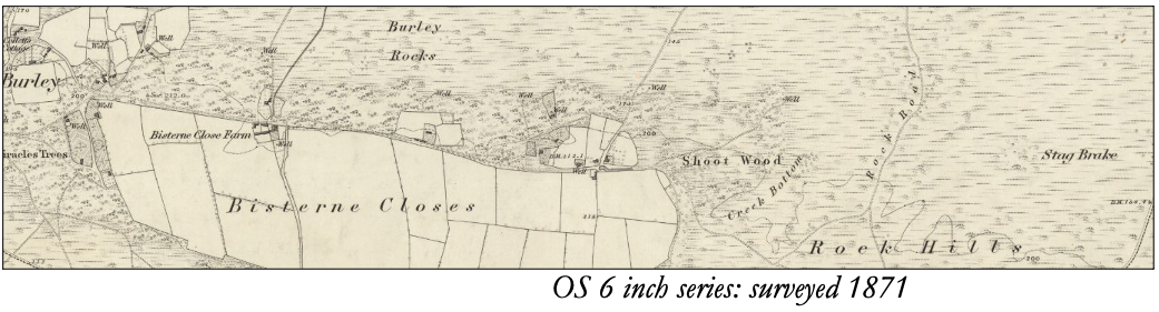
Also on the map, one of the tracks northward from Rock Hills was named Rock Road and was possibly the route the rock was transported away from the pits and distributed for use across the wider forest.
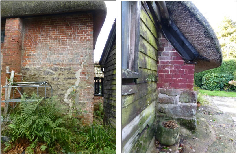
Burley Rock varies greatly in its composition, so different deposits were used for different purposes. Peter Bromfield’s family has lived in Burley for over 300 years. Growing up in the village Peter remembered his grandfather digging the rock from the pits to be used around the village. The harder and larger pieces would be delivered by horse and cart to wherever it was required and most frequently he remembers it being used for the foundations of outbuildings and barns. The friable deposits, along with the waste from the shaping of the large blocks, was used for maintaining the lanes, Another village resident remembers that 50+ years ago, when it rained heavily, at the junction of the school playground and the brick walls of the earliest school buildings, the playground would be running with rusty red water. That would suggest that the foundations of the first school building may be of Burley Rock.
As Peter Bromfield recounted, between the two world wars Burley Rock was being used mainly for foundations, but older houses in the village were often built with not only foundations of Burley Rock, but also substantial amounts of the rock in the walls.
Above:
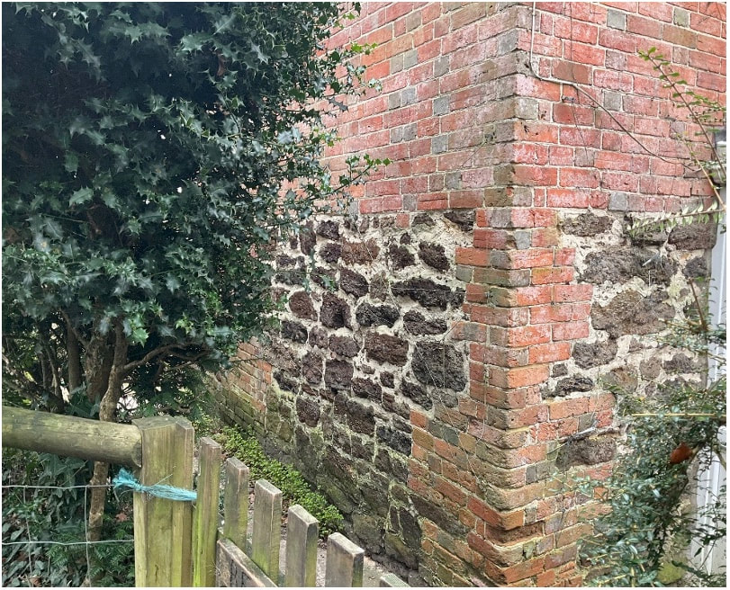
Burley Garage Cottage. Located in the centre of the village, this cottage has walls containing various amounts of Burley Rock.
Burley Garage Cottage. Located in the centre of the village, this cottage has walls containing various amounts of Burley Rock.
|
Left: Burley rock in the walls of Beacon Cottage, Castle Hill Lane. |
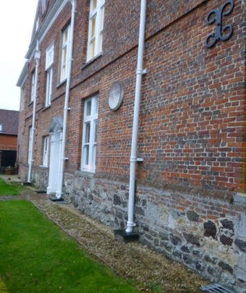
At Little Pound Farm, Pound Lane, the ground floor is built with Burley Rock and the first floor is of brick. There is every possibility that there are other buildings in the village whose external walls are covered by a coat of whitewash or render that conceals the rock from which they have been built.
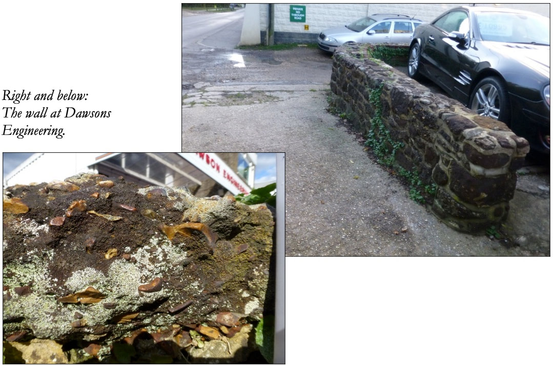
The most prominent place where the rock has been used is close to the centre of the village, at Dawsons Engineering, Pound Lane. The garage wall was built delineating the boundary between the forecourt and the entrance to Garden Road and is said to have been built from material salvaged from an old cottage that had been demolished. It is easily accessible and is the perfect place to take a close look at the range of composition of the rock and appreciate its quality as a building material.
The most prominent place where the rock has been used is close to the centre of the village, at Dawsons Engineering, Pound Lane. The garage wall was built delineating the boundary between the forecourt and the entrance to Garden Road and is said to have been built from material salvaged from an old cottage that had been demolished. It is easily accessible and is the perfect place to take a close look at the range of composition of the rock and appreciate its quality as a building material.
Clearly visible as one walks around the village are some of the outbuildings where Burley Rock has been used.
|
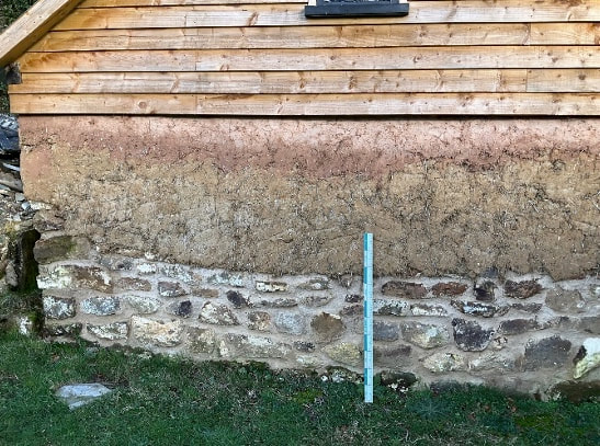
Left: Recently restored outbuildings at Shappen. The lower courses are of Burley Rock, above that, almost to eaves height, it is cob and above that it is timber clad. |
|
Right: Mill Lawn |
|
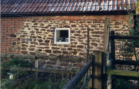
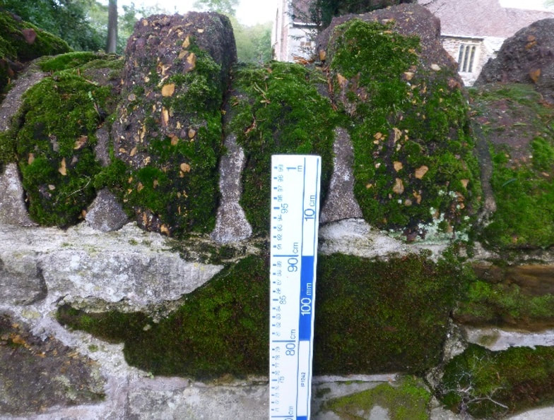
The rock was also used across the wider Forest, and has been identified in the topping of the wall of St Mary and All Saints Church, Ellingham (below left) and for the bottom courses of the north wall of the Kings House, Lyndhurst (below right):
|
|
For a well-illustrated detailed account of the rock, its composition and formation, see the website:
Geology of the New Forest: Dr Ian West: wessexcoastgeology.soton.ac.uk/New-Forest-Geology-Guide.htm
Geology of the New Forest: Dr Ian West: wessexcoastgeology.soton.ac.uk/New-Forest-Geology-Guide.htm
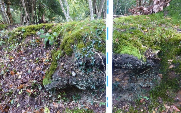
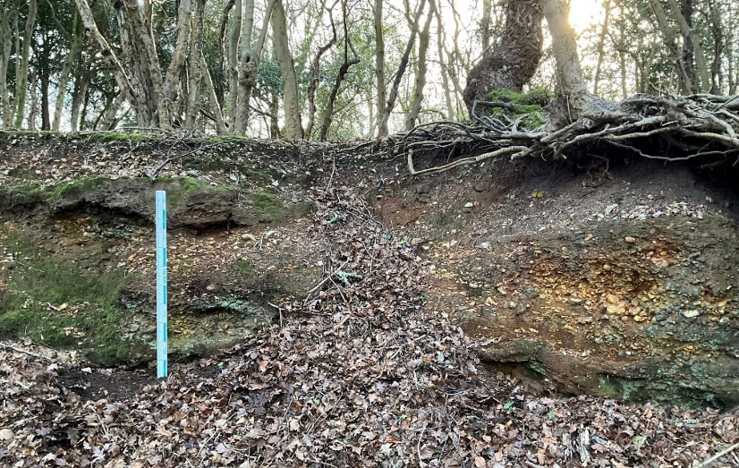
OUTCROPS OF BURLEY ROCK AROUND THE VILLAGE
|
|
Rock pits and an outcrop close to the road are places where the rock can be examined.
|
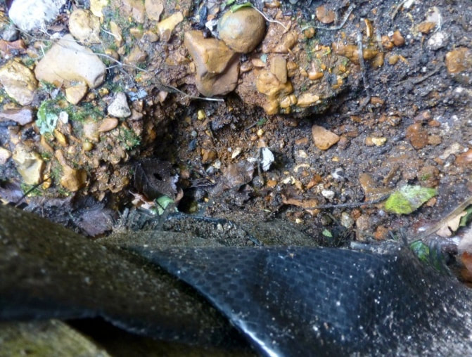
During Dig Burley (2019) a test pit uncovered the surface of the Burley Rock layer - the point where the digging could go no further. © Jo Smith
|
