Background Information and Maps
A good starting point is New Forest Knowledge: www.nfknowledge.org
Several ways of interrogating the site, you can do some general searches or you can use the tabs at the top and search within various data sources or subjects.
A new webpage has also been created on New Forest Knowledge specifically for "Dig Burley":-
https://nfknowledge.org/contributions/dig-burley/
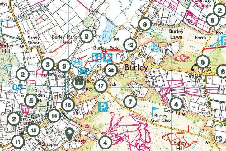
The NF Knowledge website has an extremely detailed interactive map facility allowing various historical overlays on a variety of base maps and even LIDAR. Here is an example (appears in lower half of the webpage), you can enlarge the map and adjust the various overlays with the icons in the top right hand corner of the map area, together with altering magnification and area shown with your mouse:-
https://nfknowledge.org/#map=14/-1.7/50.83/0/4:1:1|5:1:1|6:1:1|7:1:1|8:1:1|9:1:1|10:1:1|11:1:1|12:1:1|21:0:0.6|35:1:1|36:1:1
https://nfknowledge.org/#map=14/-1.7/50.83/0/4:1:1|5:1:1|6:1:1|7:1:1|8:1:1|9:1:1|10:1:1|11:1:1|12:1:1|21:0:0.6|35:1:1|36:1:1
Here are the same overlays on the LIDAR base map:-
https://nfknowledge.org/#map=14/-1.7/50.83/0/0:1:1|7:1:1|8:1:1|9:1:1|10:1:1|11:1:1|12:1:1|13:1:1|21:0:0.6|35:1:1|36:1:1
https://nfknowledge.org/#map=14/-1.7/50.83/0/0:1:1|7:1:1|8:1:1|9:1:1|10:1:1|11:1:1|12:1:1|13:1:1|21:0:0.6|35:1:1|36:1:1
Drivers New Forest Maps – Tree and Inclosure Surveys
2nd edition 1813 can be accessed online here: http://www.newforesthistoryandarchaeology.org.uk/historic-maps.html
3rd edition 1849 can be accessed online here: http://www.geog.port.ac.uk/webmap/hantscat/html/lgric2.htm
National Library of Scotland Maps
A great resource of georeferenced and digitised maps:
https://maps.nls.uk/geo/find/#zoom=5&lat=56.0000&lon=-4.0000&layers=102&b=1&point=0,0
You can zoom to the area of interest and see what maps are available and have a play around with.
Here is an example of a map centred on Burley with multiple map choices available from various tabs:
https://maps.nls.uk/geo/find/#zoom=14&lat=50.8280&lon=-1.7015&layers=102&b=7&point=50.8283,-1.6581
It is also possible to compare a selection of historic maps to modern maps or satellite layers side by side. Here is an example centred on Burley. To vary either map use dropdown on 2. Select a map series:
Magnification can be adjusted using your mouse scroller.
https://maps.nls.uk/geo/explore/side-by-side/#zoom=14&lat=50.8312&lon=-1.6964&layers=1&right=Opendata
Hampshire Historic Environment
https://maps.hants.gov.uk/historicenvironment/
This is the public database of the archaeology found in Hampshire, you can search using the map, but also has a lot more material and information on here including atlases of Hampshire archaeology through different archaeological periods.
If you type in the Grid Reference SU211030 into the "Find Location" search box then you will arrive at Burley!
Clicking on the Green Triangles gives more details of the HER record at that location.
The Atlas of Hampshire's Archaeology
The Historic Environment Record (HER) contains around 50,000 entries that describe the known archaeology of Hampshire. Analysing the distributions of this complex data by using GIS allows fascinating insights into the evolution of the Hampshire landscape. The Atlas of Hampshire's Archaeology presents HER data in a graphic and understandable way and provides the opportunity to enjoy and understand the archaeological story of Hampshire. Displaying the HER data alongside other information, such as topography, rivers, geology and landscape allows new insights and the patterns of data to be readily appreciated. The Atlas of Hampshire's Archaeology was developed to support an understanding of the archaeological potential of different landscapes. The maps are equally interesting to a wider audience including those seeking to know what has been found in their area, students and academics undertaking research, and consultants preparing advice for developers. The following pages offer an opportunity to share the emerging story of Hampshire. Download the comprehensive and detailed 15.4Mb pdf file here:-
http://documents.hants.gov.uk/archaeology/TheAtlasofHampshiresArchaeology.pdf
Portable Antiquities Scheme
A database of finds found by individuals, normally metal detectors, but does include others now. PAS can be searched on NFKnowledge above as well.
https://finds.org.uk/counties/hampshire/
Here is the harness pendant recently (2014) found in Burley showing the coat of arms used by the Earl's of Arundel throughout the 13th and 14th Centuries:-
https://finds.org.uk/database/artefacts/record/id/719799
More recently (2017) - An Iron Age gold stater of the Regini and Atrebates, early uninscribed British 'A', Rudd's 'Westerham South' type (ABC 482), dating to 60-50 BC:-
https://finds.org.uk/database/artefacts/record/id/854404
Historic England PastScape lists 109 results for Burley (barrows, axes, kilns, etc.):-
https://www.pastscape.org.uk/SearchResults.aspx?rational=q&criteria=burley%20hampshire&search=ALL&sort=4&recordsperpage=10
